

Learning from Amsterdam on how to build people and bike-friendly cities
Fast Company recently featured my master’s research on how Amsterdam became a biker’s paradise and why other cities can do the same:
These Historical Photos Show How Amsterdam Turned Itself Into A Bike Rider’s Paradise
The author found me when my professor Marco te Brommelstroet (aka, @FietsProfessor) tweeted one of my historic-contemporary photo pairs — views of Amsterdam’s Harlemmerdijk — and the tweet went viral.
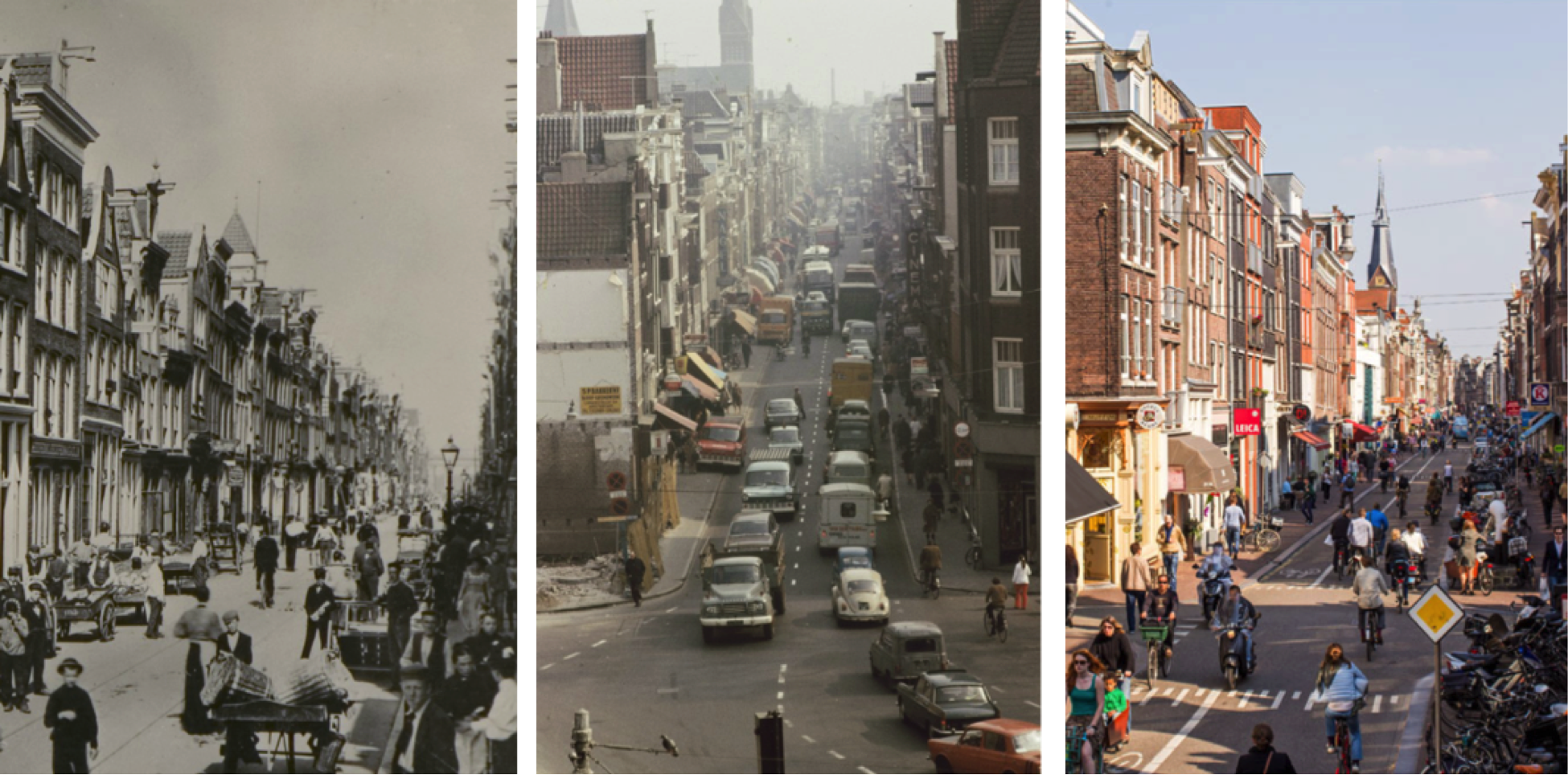 Haarlemmerdijk 1900, 1971 & 2013. Historical photos by Amsterdam Archives & modern perspective by Thomas Schlijper.
I’m happy that the key lessons of my thesis are available to a wider audience. One of the most important is that cities can learn to make themselves people- and bike-friendly by looking into their 0wn pasts. Planners don’t need expensive consultants to find historic photos of their streets prior to World War II. The current trend to reallocate space to pedestrians and cyclists in Paris, Oslo, Hong Kong and other cities represents not a revolution but a return to a time when when cities were for people – not cars.
If you’re coming to Amsterdam, then you can learn about these transformations by taking a Sustainable Amsterdam tour in which I cover the evolution of Amsterdam’s land-use and mobility policies over the past century and explain how other cities can undergo the same transformation. If you’re not coming to Amsterdam but would like to collaborate on similar projects, please get in touch (cornelia@sustainableamsterdam.com).
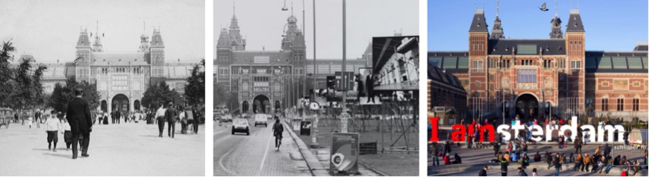 Museumplein 1906, 1987 & 2014. Historical photos by Amsterdam Archives & modern perspective by Thomas Schlijper.